
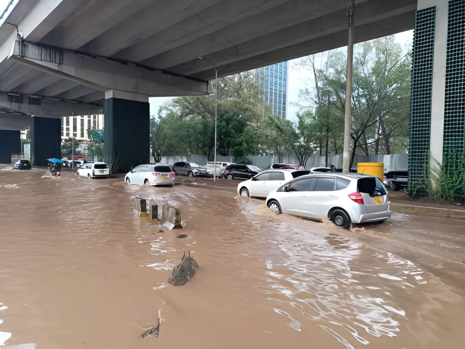
Nairobi is preparing for a potentially difficult October-December rainy season, with 246 areas across the city identified as possible flood hotspots and up to 100,000 households projected to face the worst-case impact.
The Kenya Meteorological Service Authority has forecast above-average and wetter-than-normal conditions during the short rains, raising concern over possible flooding linked to the expected El Nino phenomenon.
In response, the National Disaster Operation Centre (NDOC), Kenya Red Cross and Nairobi County Disaster Management sector have mapped areas likely to experience the greatest impact and are putting measures in place to reduce the effects of heavy rains.
Nairobi County Chief Officer in charge of Disaster Management Bramwel Simiyu said the county has already started clearing drainage systems and waterways to prevent storm water from being blocked.
"We are focusing on mitigation and preparation at this point in time but also preparing our response perspective to be ready, and in the worst case scenario, to help those who will be affected," Mr Simiyu said.
Among the major roads expected to experience flooding are Uhuru Highway, Jogoo Road, Kangundo Road and Thika Road, as well as some roads in Westlands.
The county has also identified areas where the effects of flooding could be severe and require humanitarian assistance. These include Mukuru informal settlements and the Industrial Area corridor, covering Pipeline, Imara Daima and Kware.
Another flood-prone corridor comprises Gatina, Waruku and parts of Waithaka.
Estates around Nairobi Dam, including parts of Langata and Kibra, have also been listed among areas at risk based on previous flooding patterns.
"The medium case scenario is about 22,000 to 25,000 households that we anticipate to be affected. We are also projecting the worst case scenario of up to 100,000 households that will be affected and we are prepared for that," Mr Simiyu said.
The county has identified facilities, including schools, that could be used as holding areas if residents need to be moved from flood-prone locations.
Emergency teams will also be placed on standby, with emergency lines, boats and relief supplies expected to be available for rescue operations, particularly where homes become marooned by floodwater.
The Nairobi Central Business District (CBD) has also been listed as an area that could experience flooding based on previous occurrences. The county government said the CBD will be closely monitored and measures taken to reduce the possible impact.
The preparations come days after Principal Secretary for Health Mary Muthoni announced that El Nino contingency plans had been rolled out to guide national and county governments, emergency agencies, humanitarian organisations and development partners in dealing with flood-related health emergencies.
The plans are aimed at helping agencies anticipate, prevent, detect and respond quickly to health threats arising from flooding.
The Ministry of Health has warned that particular attention will be required for water and food-borne diseases such as typhoid, cholera, dysentery, hepatitis A and other diarrhoeal illnesses.
Such diseases can rise when floodwater contaminates drinking water sources and damages sanitation systems.
"Through the National Health Sector El Niño Task Force and emergency operations structures, partners are supporting joint planning, rapid assessments, emergency medical services, referral and evacuation, community outreach, risk communication, relief support and assistance to vulnerable populations," the PS said.
Residents have been urged to follow evacuation and other safety instructions issued by authorities as the rainy season approaches.
Kenyans have also been advised against walking or driving through floodwater and told to rely on information provided by the Ministry of Health, county governments and authorised emergency agencies.